
About Mt. Tarak
Mt. Tarak is one of the mountains in the Philippines which is in debate if it’s a major or a minor climb; major because of its long trail and altitude and minor because of its trail class. Tarak is situated in Brgy. Alas-asin, Mariveles, Bataan, three hours travel from Manila. This mountain has an amazing and cool ambiance because of its rich forest areas.

The major jump off to hike Mt. Tarak is at Brgy. Alas-asin Hall, a walking distance from the highway. At the Barangay Hall, registration and fees are to be processed. Washrooms are also available. By the highway, stores and restaurants are available for travelers.

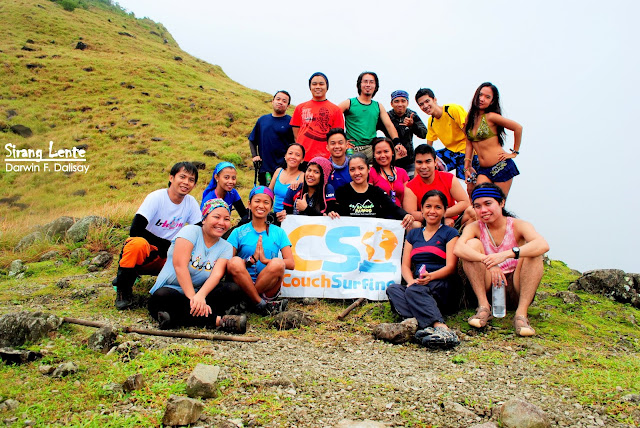
Class picture before we started ascending.

From the jump off, the first part is walking on a concrete road, by the village, passing by the front of the residential houses. The village area is wide and open, covered with green grass. There are dogs, cats, chickens, horses, cows, and carabaos everywhere.
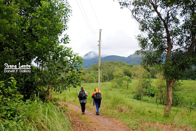
After the concrete roads in the village, the next part is walking on an ascending terrain.

Registration at Nanay Kurding’s house.

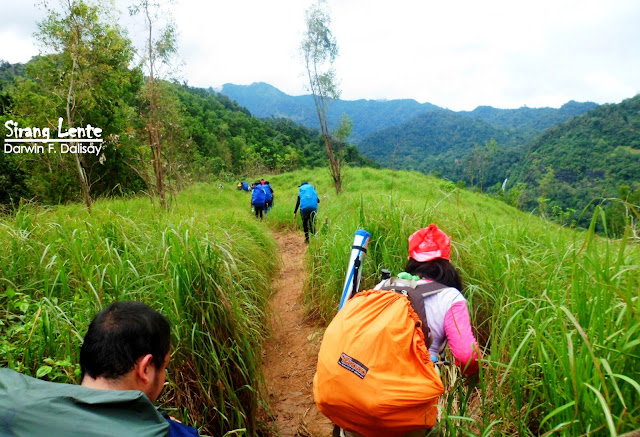
The trail is ascending, covered with cogon grass; there’s also a part that is open and has a viewing deck, seeing the nearby island and provinces. During our hike, the soil on the trail was very sticky and slippery. Ranges from afar can also be seen while walking on the trail. Everywhere is green.

After the open terrain, the next part was a well-established trail covered with shade from the tree leaves. It’s an uphill and downhill to the Papaya River. Bodies of water like waterfalls, streams, and rivers also spread in the area.

Papaya River is one of the gems of Tarak. This river has crystal clear waters, cool and totally refreshing.

We welcome our Couch Surfers and LGBT friends.

The photo above was taken using my 3.2 MP cell phone camera before the storm started. Tarak has camp sites on both sides of the Papaya River. The camp sites are both wide open spaces and slightly ascending. The relaxing sound of the splashing water can be heard while resting.

From the Papaya River campsite, it’s a continuous ascent to the ridge. The trail wasn’t easy because the terrain was muddy and slippery. The trail is complicated, but trail marks are visible hanging on the trees or on the stones.

Upon our arrival, the ridge is covered with thick fog, preventing us not to seeing the gorgeous surroundings.

Tarak Ridge is also perfect; the glamorous flowers were just blooming perfectly.

On the other hand, the ridge of Mt. Tarak is an open and wide space to the summit, covered with cogon and grass. I didn’t see the real beauty of Tarak this time because of the fog, but I was satisfied with everything. This journey was remarkable because other people were added to my life. And to the storm that hit us that evening, it made us strong and was life-changing.
How to Get to Mt. Tarak
On EDSA, we rode in a Genesis Bus bound for Bataan and alighted at Brgy. Alas-asin, Mariveles. This spot is already a known drop-off point for the hikers.
On the other hand, traveling in the Philippines is highly recommended because of its hidden beauty. Want to explore stunning places? Here’s my full travel guide after visiting all 82 provinces in the Philippines.
No comments:
Post a Comment
Enter Comment Below: