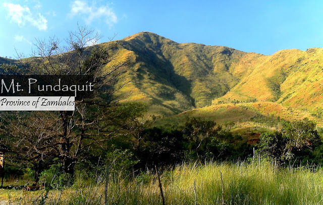
Hiking Mt. Pundaquit is the perfect way to visit Anawangin Cove, well for trekking enthusiasts. While walking on the flat surface at the entrance of the mountain, you can see its gorgeous scenery that awaits to be discovered. The mountain's entrance is just ten minutes from the shoreline of Brgy. Pundaquit and its trail starts by passing across the grass and shrub lands.
Showing posts with label Mountains. Show all posts
Showing posts with label Mountains. Show all posts
Mt. Romelo + Buruwisan Falls, Laguna: Hike Guide, Height, Difficulty
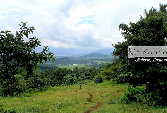
Hiking Mt. Romelo and rappelling the Buruwisan falls was fun and amazing experience because the area has rich bio-diversity, both flora and fauna. There is a body of water that flows on its terrain, thus, this mountain has a high concentration of trees and other plants. It can bring a good combination of adventure and relaxation. Having said that, Laguna, together with the provinces of Batangas and Cavite, makes the region the center for outdoor activities.
Mt. Hapunang Banoi Day Hike Guide
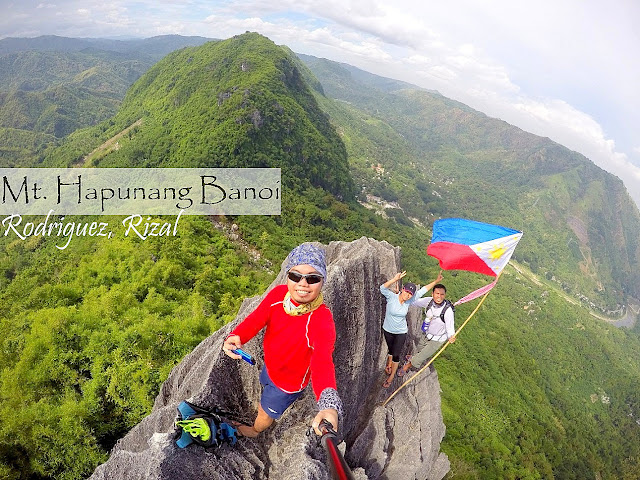
Mt. Hapunang Banoi is a dwarf and a hiking-friendly mountain in Montalban, Rizal which can give you a tantalizing view of nature's beauty. Together with Mt. Pamitinan and Mt. Binacayan, Hapunang Banoi is ne of the must hiked mountains in the area because it is also surrounded by lucius greens trees which makes the area looks relaxing. Plus the exhilarating terrains added an adventure to hikers. In the center of these mountains is Wawa Dam, a water reservoir built by the American. This area was chosen because it's a catch basin of the three mountains.
Mt. Pamitinan, Rizal Day Hike Guide
Mt. Pamitinan is one of the most hiked mountains because it became famous due to it's accessibility from Manila. It's been a long time since we planned to visit Wawa Dam and hike the twin mountains, for some reasons, it resulted to "drawing." Hiking this mountain is a bit challenging but will definitely give you an amazing and wide view of greens surrounding Wawa Dam and part of Sierra Madre. Also, the area is famous because of the legend; according to stories: Bernardo Carpio used his super power to separate this mount from Mt. Binacayan, as a result, there's a space in between them, where Wawa Dam is situated.
AFTER COVID-19: LIST OF BEST PLACES TO RELAX (BY REGION)

When COVID-19 was declared by the World Health Organization as a global Pandemic, we were hiking Mt. Hamiguitan, a UNESCO World Heritage site in Davao Oriental. It was our second day when we passed by a small spot, along the trail, with a low reception but able to receive messages. Though we were still connecting the dots due to the lack of complete details because of the slow connection, one thing was precise, the president already declared the lock-down of the NCR. Instead of enjoying the beauty of Hamiguitan, we were silently walking on the trails and our minds were focused about going back to Manila. After the tiring and expensive travel to Clark Airport, today is the Day 11 of the community quarantine, with help of traveler and hiker friends, I am creating this list of tourist destination visit after the COVID-19 Pandemic.
MT. TABAYOC, BENGUET: HIKING GUIDE AND ITINERARY
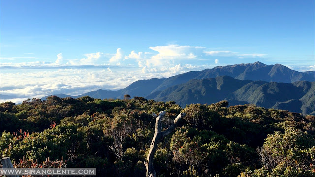
One of the most prominent mountains in Luzon is Mt. Tabayoc because it is the second highest mountain in Luzon (2842 MASL) and is one of the most preserved virgin forest in the Philippines, with a rich bio-diversity of flora and fauna. Your hiking experience will definitely be rewarded with a breathtaking beauty of sea of clouds, artistic view of the surrounding terraces, a cool weather, a relaxing green ambiance, and a life changing tranquility by the lake. Also, there are a lot of mouth watering at lost cost and fresh harvest vegetables in the area.
HIKING GUIDE: MT. TENGLAWAN, BENGUET
Among Among the Bakun Trio mountains, Mt. Tenglawan is the most difficult to hike because of its long terrain and assault, although its trail class and technicalities can be placed to moderate level. Tenglawan has an amazing shape, from afar (photo above). Based on how it looks and shape, this giant can be compared to Mt. Guiting-guiting in Romblon.
HIKING GUIDE: Mt. Daguldol, Batangas
Batangas in prominent with their beautiful beaches and outstanding underwater activities but if you want to strike two different destinations in one day, it is possible. Not so far from the shoreline of San Juan, Batangas, you can find Mt. Daguldol, one of the hiking destinations in the province. This mountain is one of their assets in terms of mountain ranges with beaches on the background. Daguldol is perfect for first time hikers because the trail is simple to moderate, but the beauty on the summit was remarkably beautiful.
MT. MANABU (Hiking Guide, Itinerary, Things you need to know)
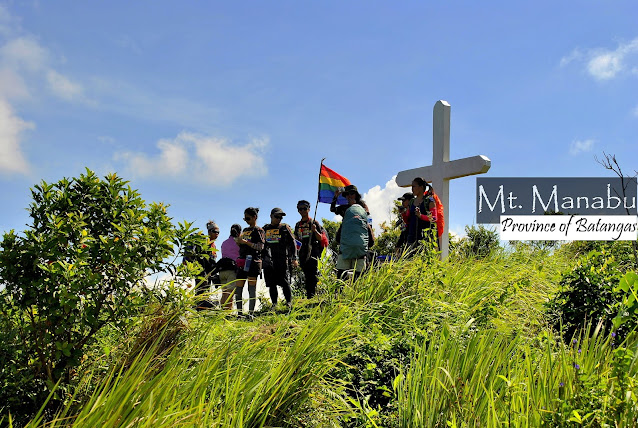
Derived from the phrase "mataas na bundok," Mt. Manabu hides something that is breathtaking in its forest areas. Gorgeous flora and distinct fauna can be found on the terrain that is composed of tall hardwood and fruit-bearing trees, coconuts, shrubs and grasses. This type of terrain serves as a paradise for the civet cats that produce expensive coffee. In addition, its summit has a wide view of the mountain ranges from afar and the nearby villages and has a cool and refreshing sea breeze.
HIKING GUIDE: Mt. Malipunyo, Batangas
Mt. Malarayat is another name given to the Mt. Malipunyo ranges in Batangas, one of the hiking destinations in Southern Luzon. Proximity wise from Manila and nearby provinces, it's a big CHECK. For two to three hours land travel and a whole day trek, you can enjoy the stunning views and extreme experience that can be found on the terrains of this mountain. It is also considered as “first timer friendly,” as it has a simple to moderate trail types. The terrain is abundant with different type of trees and colorful flowers that serve as as paradise of the wildlife.
HIKING GUIDE: Mt. Tibig, Batangas
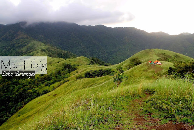
Hiking for one to two hours, you can easily reach the summit of Mt. Tibig. This mountain offers a relaxing trek because of its trails and gorgeous picturesque on the summit. With reggae music on the background, the stunning mountain ranges, covered with greens, will definitely make your eyes relaxed while the fresh and cool wind will help your soared muscles recover - such perfect place for bonding. Accessibility from Manila is super check because it is situated in Lobo, Batangas, a two to three hours land travel from the metro.
HIKING GUIDE: Mt. Mabilog and Pandin Lake
Aside from the historical sites, food, and rich culture, Laguna also has great flora and fauna that can be found on the mountainous and forest areas. Mt. Mabilog is just one of the mountains lying in the province where a vast diversity of wildlife can be found. Hiking Mt. Mabilog can definitely bring an extreme and remarkable experience because of its muddy trail but there's a wide picture of the Laguna and the nearby mountains, such as Mt. Banahaw and Mt. Cristobal. Not only that, the reflection of the skies can also be seen on the water of the seven lakes.
Hiking Mt. 387 and the Batong Amat
Mt. 387 is one of the newly marked hiking destinations in Luzon because of its breathtaking beauty, spectacular and tantalizing golden sunset, fresh and cool ambiance – this mountain can be considered as one of the most scenic mountains in the Philippines. Mt. 387 is situated in the province Nueva Ecija which is dubbed as the “Rice Granary of the Philippines,” a three to four hours travel from Manila. Our photos below will explain more about what Mt. 387 can offer.
Video Blog: Mt. Tabayoc and its virgin forest
Mt. Tabayoc has the most preserved virgin in the Philippines; the trails that are covered with mosses, trees and other ornamental plants are the living proof. On the summit there's a 360 degrees view of the Cordillera Mountains, the shape of Mt. Pulag and the spectacular Sea of Clouds. For gorgeous photos and our itinerary, click here: Sirang Lente.
Check my YouTube Channel here -> SirangLente.
VIDEO BLOG: A Drone Shot of Mt. Timbak
Mt. Batulao Dayhike, Batangas
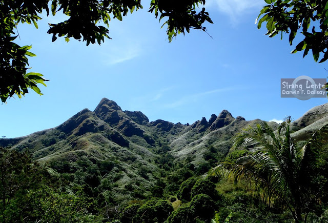
Mt. Batulao is one of the famous hiking destinations in Batangas for those people searching for challenges and outdoor adventures. This mountain is another gem and pride of Southern Luzon which is 2-3 hours travel from the Manila, very accessible to both private and public vehicles. Batulao is famous because of the breathtaking view of its ranges and slopes. Its surface has an amazing shape covered with luscious and relaxing greens. Since it's just a few kilometers away from Tagaytay, which is the usual side trip, its ambience is really cool.
Mt. Talamitam | BHM on 3rd

Our original plan was Mt. Maculot, but two days before the climb, it was changed to Mt. Talamitam in Nasugbu, Batangas. Night trekking was certainly full of fun since there was no problem with the harmful sun UV rays. Talamitam is covered with cogon grass and shrubs; no hard wood or trees that can protect the hikers from the sun rays. Its highest point measures 630+ MASL with a gorgeous ambiance on top. There's one hundred meters assault to the summit which added an amazing adventure to the hikers. Mt. Batulao and Mt. Pico de Loro were just two of the well known mountains nearby.
Mt. Maculot: Hiking Guide

Mt Maculot is one of the mountains lying in southern Luzon which is prominent to mountaineers because of its special feature. Maculot is one of the best options for day hikes because of its minor trail type, terrains that are covered with trees and surrounded by grass and shrubs, the air is fresh, cool ambiance and a perfect location for a stunning shot with the world-famous and most active Taal Volcano on the background. The rockies is one of the best and famous part of Maculot.
Faces of Mt. Apo
Mt. Apo is the tallest mountain in the Philippines, 2,956 MASL. It was a tough journey, but absolutely a life changing experience for us. Despite of its technical factors like the assault and steep trails, extreme coldness, tiring hike and etc. that measured my strength, I was able to conquer my own fears. It's hard to tell and explain, so these photos below will explain more.
On the Summit of Mount Apo | Day 3
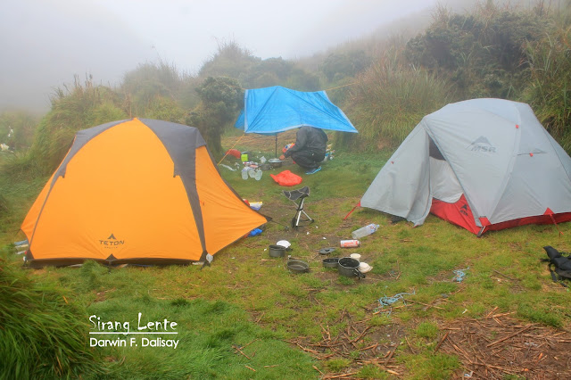
Hiking to the summit of Mount Apo - it was the longest night I ever had. When I woke up around 1AM, I did not fall asleep for some reasons. The wind was strong and as it penetrates the fabric of the tent and hits my skin, it was like a knife that cuts because of its temperature. We were also bothered by the bad weather that might affect our ascend to the summit.
Subscribe to:
Posts (Atom)
