Photo: Selfie at Ozamiz City Hall. |
Click Helpful Links Below:
Fort sa Cotta is one of the Spanish-built fortresses in the Philippines. The main purpose of this edifice is the same as the function of Fort Santiago in Manila and Fort sa Pedro in Cebu which is to protect the city/town against the attacks of the Moro pirates. This sturdy structure is made up of coral stones, thus, during World War 2, Fort sa Cotta served as a garrison, barracks and storage area for the military. Today, it is one of the most popular historical sites and a landmark in Misamis Occidental and in the entire Northern Mindanao region. During my visit, it was closed due to renovation. READ: SOLO-BACKPACKING IN ZamBaSulTa, Region 9, and Misamis Occidental.
My accommodation was at the Green Ridge Apartelle which is near the capitol compound, so early in the morning, using Google Maps, I had my walking tour at the capitol building and to Kaamulan Park and Zoo, where I met the animals that I usually see online, and on TV. The area is surrounded by greens, the breeze is cool, the air is fresh, and the landscape is Instagrammable. The perfect time to visit Kaamulan Park and Zoo is in the morning, and the entrance fee is free. READ: SOLO-BACKPACKING: Lanao del Norte, Lanao del Sur, Misamis Oriental, Bukidnon, Davao del Norte, Compostela Valley, and Davao City.
Jump to: About Green Ridge Apartelle | Location and How to Get There | Features & Amenities | My Experience | Where to Book | Nearby Tourist Spots | Travel Tips
Green Ridge Apartelle is a budget-friendly accommodation located in Malaybalay City, Bukidnon. Known for its peaceful atmosphere and clean, well-maintained rooms, it’s ideal for solo travelers, families, and backpackers exploring the highlands of Mindanao. It’s a popular choice for both short and long stays due to its strategic location and affordability.
Jump to: About Pacifico | How to Get There | What to Do | Where to Stay | Suggested Day Trip Itinerary | Sample Budget | Travel Tips
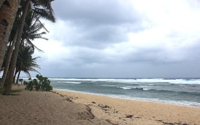
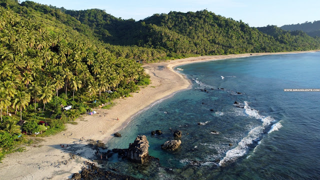
Pacifico is a quiet seaside hamlet on Siargao’s northeastern coast, sheltered by palm forests and known for its laid-back surf culture and uncrowded white‑sand beaches.
While we were en route to Pacifico, we passed by the roads decorated with draft live mango trees and tall coconut trees present on both sides, such a gorgeous landscape. Then, we also passed by the coconut plantation, another top destination in Siargao. On this spot, the sea breeze is cool and fresh with a wide view of the countless coconut trees and mountain slopes.
Jump to: About Cloud 9 | How to Get There | What to Do | Suggested Day Trip | Sample Budget | Where to Stay | Travel Tips
Cloud 9 is the world-famous surf break in Siargao, renowned for consistent reef breaks and tube waves. The iconic bamboo boardwalk, built in 2013, has become a magnet for sunrise photographers and surf fans seeking that perfect wave shot.
Jump to: About Ganano Falls | How to Get There | Entrance Fee & Operating Hours | Things to Do | Sample Itinerary | Budget and Expenses | Where to Stay | Travel Tips
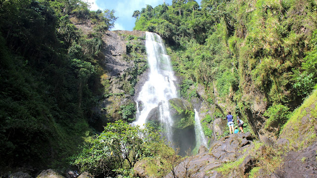
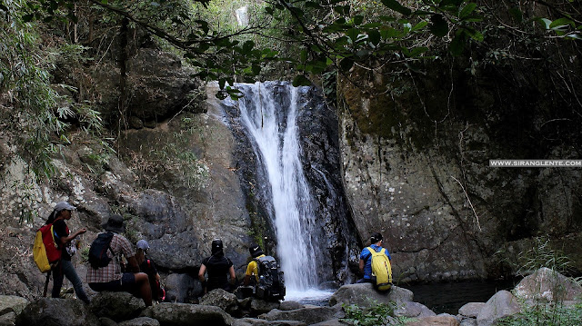
Ganano Falls, also spelled Gagano Falls, is a towering waterfall tucked in the forested mountains of Diffun, Quirino Province. Surrounded by lush vegetation, it boasts a multi-tier cascade that plunges into a cool, emerald basin—ideal for swimming, nature photography, and eco-adventures.
Jump to: About Governor’s Rapids | How to Get There | Entrance Fee & Schedule | Things to Do | Sample Itinerary | Budget and Expenses | Where to Stay | Travel Tips
Governor’s Rapids is one of Quirino Province’s most popular natural attractions, located in Maddela. Known for its stunning limestone rock formations and turquoise river, it offers bamboo rafting, kayaking, swimming, and relaxing river views—perfect for eco-adventure seekers and laid-back travelers.
Jump to: About Landingan Viewpoint | How to Get There | Best Time to Visit | Things to Do | Sample Itinerary | Budget and Expenses | Where to Stay | Travel Tips
Landingan Viewpoint is a scenic hilltop destination in Nagtipunan, Quirino Province. Known for its 360-degree views of the Sierra Madre mountain range, rolling hills, and farmland below, it is often compared to "Batanes of the North" because of its dramatic landscape. It’s perfect for sunrise photos, camping, and drone photography.
Jump to: About Quirino | How to Get There | Things to Do in Quirino | Sample Itinerary | Budget and Expenses | Where to Stay | Travel Tips
Quirino is a landlocked province in Cagayan Valley, known for its untouched natural wonders like waterfalls, caves, rivers, and forest reserves. It’s an off-the-beaten-path destination perfect for eco-adventurers and backpackers seeking raw landscapes and fewer crowds. By the way, it's my 81st Province in the Philippines.
Jump to: About Inasakan Beach | How to Get There | What to Expect | Things to Do | Travel Tips | Where to Stay | Nearby Attractions
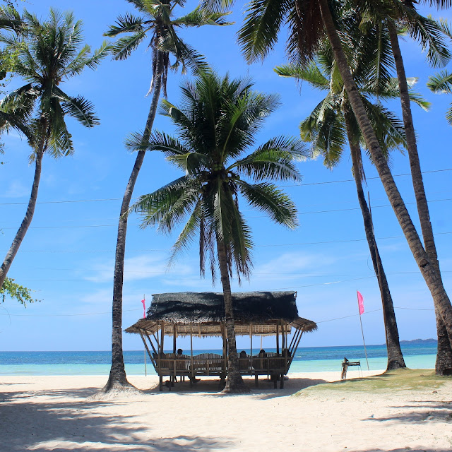
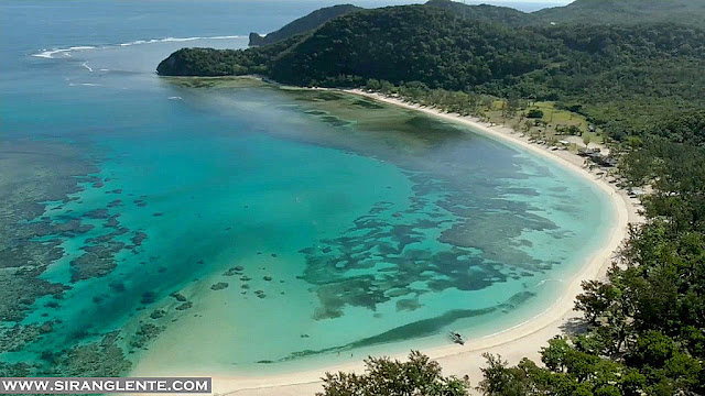
Inasakan Beach, also called Inasakan Cove, is a secluded beach paradise located in Ilin Island, just off the coast of San Jose, Occidental Mindoro. Known for its powdery white sand, turquoise water, and peaceful surroundings, it remains untouched by mass tourism — perfect for travelers seeking raw and quiet beauty.
READ: Rates, Location, How to Get Here, My Solo-Backpacking in Zamboanga del Norte
In Butuan City, Agusan del Norte | The Filipino word Baranggay came from the word: Balangay or Balanghai which is watercraft used by the ancient people in the Philippines for transportation and for barter and trade. If I am not mistaken, it was discussed when I was in the fifth grade, in HEKASI. I am happy that today, it’s time to see the actual relics of Balangay, discovered in Butuan. Since the guard did not allow me to use my DSLR or even my digital camera.
Tinago Falls is the top tourist attraction in Iligan City, Lanao del Norte. Its name literally translates to "hidden" in English,. This majestic waterfall captured the attention of travelers worldwide because of its grandeur. The crystal clear and cool water falling by the walls of the artistic rock formation creates a world-class picturesque - such picture-perfect landscape. On the other hand, the area is surrounded by greens that help in preserving the tranquility and relaxing atmosphere.
Lignon Hill has a beautiful landscape and a 360-degree view of Legaspi City and Mt. Mayon. By the way, after Daraga Church, we headed to this stunning place. Kuya Lijong dropped us by the entrance, and we settled the payment, but he left. Instead of a continuous ascent, we had a buko break first. Relaxed and regained the fluid we lost. The road to the summit is concrete and surrounded by hardwood trees, so the ambiance while we were walking was relaxing, with the cold wind blowing. And after 30 minutes, we finally reached the summit. Beautiful landscape and a 360-degree view of Legaspi City and the hiding Mt. Mayon. Commercial establishments such as souvenir shops and food stalls are available. By the way, restrooms are also available. READ: BACKPACKING ALBAY, SORSOGON, CATANDUANES
This is Our Lady of the Gate Parish Church, also known as Nuestra Señora de la Porteria Parish Church, commonly known as Daraga Church. Its structure has a Baroque design built by the Franciscan Friars in 1773. It served as the place of worship after the church of Cagsawa was destroyed by the eruption of Mt. Mayon in 1814. Also, Daraga Church served as the station of Japanese soldiers during the Second World War in 1945. It was rebuilt from 1971 to 1973. By the way, we still wished that Mt. Mayon would show its perfect cone at our next destination. So, Kuya Lijong brought us to this historical church. The location is also a perfect spot to see the beauty of Magayon, who was playing hide and seek with us. The clearing was negative, so let's proceed to its history. READ: BACKPACKING ALBAY, SORSOGON, CATANDUANES
It's a beautiful and Instagrammable spot in Albay. Sumlang Lake has a stunning landscape, surrounded by trees, flowers, and other plants. It could have been perfect if a clear view of Mt. Mayon was on the backdrop; however, it was hiding during our visit. We waited almost an hour while enjoying the view and eating ice cream, but Magayon was still hiding. We were brought here after Hoyop-Hoyopan Cave. READ: BACKPACKING ALBAY, SORSOGON, CATANDUANES
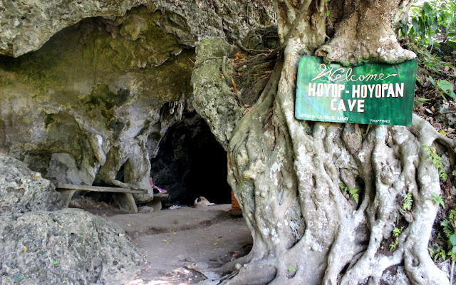
Its name was derived from their local dialect "Hoyop-hoyopan," which translates to "blow or blowing." The wind enters the cave opening, blows through the cave's cavern, and exits to the other side. That blowing wind is the reason why the ambiance inside the is cool and relaxing. Aside from that, there are a lot of artistic stalactites, stalagmites, and columns inside the cave. What's different than the other cave? There's a round concrete dance floor inside this cave. According to our guide, the locals created the dance floor to hide their party and gimmicks, which were not allowed before. After Cagsawa Ruins, Kuya Lijong brought us to this gorgeous cave. READ: BACKPACKING ALBAY, SORSOGON, CATANDUANES
Also known as the Cathedral of St. Gregory the Great. According to its historical data, Albay Cathedral started as a chapel built in the 1580s by Spanish missionaries. The early structure was made from local products such as wood and nipa. Then, it emerged as a stone structure in 1800. This Cathedral is one of the top tourist destinations in the province, and it was our first destination. READ: BACKPACKING ALBAY, SORSOGON, CATANDUANES
Creating an itinerary and traveling to Balut Island wasn’t easy because of its location. Also known as Malulong, this volcanic island in Southern Mindanao is definitely the top tourist destination in Davao Occidental because of its fine white sand beaches, crystal clear waters, and gorgeous landscape. Not only that, the people here are friendly and approachable. There’s a bit of a language barrier, nonetheless, locals can understand English, Tagalog, Bisaya, and I’ve heard some locals speak Indonesian. CLICK TO WATCH THE VIDEOS
Jump to: About Casiguran | How to Get There | Top Attractions | Suggested Itinerary | Sample Budget | Where to Stay | Travel Tips
Casiguran, perched at the foot of the Sierra Madre in northern Aurora, is a hidden coastal town known for its pristine beaches, clear waters, lush mangroves, and peaceful rural charm.
It is a simple paradise in Tanay that is now one of the best tourist spots in Rizal; its name translates to "hidden paradise" in English because of its beauty hidden in the woods. The area is surrounded by hardwood trees, shrubs, and other flowering plants that make the area relaxing. Not only that, since the area still has a healthy bio-diversity, you will definitely have a lazy day because of the birds singing lullabies while the cool wind blows. CLICK TO WATCH MY VLOG
Jump to: About Mt. Samat | How to Get There | What to See & Do | Suggested Half‑Day Itinerary | Sample Budget | Where to Stay | Travel Tips | Final Thoughts
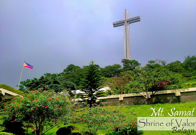
Mount Samat (≈560 m) is an extinct volcano in Pilar, Bataan, and is home to the iconic Dambana ng Kagitingan (Shrine of Valor). Built in 1970 to honor Filipino and American soldiers of the Battle of Bataan, it features a 95 m white cross with an observation deck, museum, and sweeping views of Manila Bay, Corregidor, and surrounding highlands.
Photo of Guadalupe Church. |
Jump to: About Boracay | How to Get There | Where to Stay | Things to Do | Sample Itinerary | Estimated Budget | Travel Tips
Boracay Island is one of the Philippines’ top beach destinations, known for its powdery white sand, spectacular golden sunsets, vibrant nightlife, turquoise waters, and remarkable water activities. Located in Aklan, Western Visayas, this island paradise offers both luxury and backpacker-friendly travel experiences. It is unique because it is described as one of the world's most beautiful white-sand beaches. Also, shops sell stunning accessories and other handmade local products. If you’re into eating distinct and mouth-watering dishes, either local or international cuisine, there are hundreds of restaurants at the 3 stations.
Sunken Cemetery is a historical landmark and the top tourist spots in Camiguin. Before, it was a resting place and today, it is a tourist attraction that gives money to the government and jobs to the locals. This spot has a huge cross perched into the water. Tourists can cross and step on the base of the cross using boats, of course NOT for free. Souvenir shops and stores are available by the entrance. READ: Backpacking in Surigao del Sur, Agusan del Norte, and Camiguin.
Others call it Malalison, which is an island in Culasi, Antique. It can be considered a fishing island because most residents are fishing for their livelihood. A few years back, its breathtaking beauty captured the attention of travelers after Typhoon Yolanda. It is Panay's next frontier because of its fine white sand beaches and crystal clear waters with diverse aquatic flora and fauna – it is truly a perfect diving paradise.
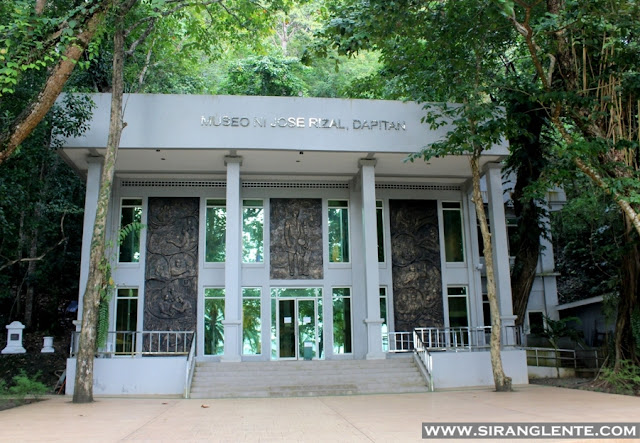
The Rizal Shrine in Dapitan (José Rizal Memorial Protected Landscape) was the place where our National Hero was exiled by the Spaniards in 1892. Today, this historical place shows his life while working as a doctor, sculptor, farmer, teacher and many others. He purchased this land after winning a lottery in 1892. Later, his mother, sisters and relatives transferred here from Calamba, Laguna. However, on January 15, 1897, the Spanish authorities confiscated all of his property. These were converted into a park and were declared a National Park in 1940 by President Manuel L. Quezon.
Jump to: About Paoay Church | History & Significance | Architecture & Style | How to Get There | Visiting Tips | Where to Stay Nearby
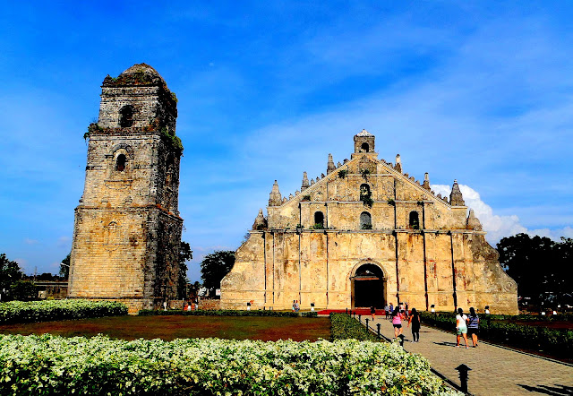
Paoay Church (St. Augustine Parish Church) stands majestically in Paoay, Ilocos Norte. Completed in 1710, it’s recognized as a UNESCO World Heritage Site under the Baroque Churches of the Philippines and a National Cultural Treasure.
Asik-Asik Falls is the top tourist spot in North Cotabato. It is a spectacular-curtain-like waterfall hiding in the mountainous area of Alamada. Its unique landscape and breathtaking beauty spread online, which captured the eyes of the world. Who says "no" to its majestic walls covered with lush green vegetation, such as moss and ferns, highlighted by the hardwood trees and the clear blue skies. In between these hanging ornaments are cold and crystal clear rushing water naturally falling on a shallow rocky pool surrounded by artistic rocks and boulders. Such a perfect place to relax and distress.
Jump to: About Tinuy‑an Falls | How to Get There | What to Expect | Fees & Facilities | Sample Itinerary | Travel Tips | FAQs
Tinuy‑an Falls is a majestic multi‑tiered cascade located in Barangay Burboanan, Bislig City, Surigao del Sur. Known as the “Little Niagara of the Philippines,” it spans 95 m wide and drops about 55 m across its four tiers.
It is one of the must-visits in Sta. Ana, Cagayan, because it has a long-curvy stretch of fine white sand landscaped with greens on the side. The sand has a mixture of colorful shells, pebbles in different shapes, and living crustaceans running back and forth. From the quaint cottages by the beach, the crystal clear water and emerald seas are visible, separated by the horizon from the blue sky. Its preserved tranquility can definitely make your day a lazy day.
Palaui Island is situated in Sta. Ana, Cagayan. Aside from the Callao Cave, this paradise became one of the top tourist destinations in the province because of its beauty that stole the eyes of the world. Since the province is situated on the North East side of Luzon, due to its topographical location, the serenity and the breathtaking beauty are well preserved.
It is one of the most climbed mountains in Southern Luzon because of its beautiful landscape and cool and relaxing ambience. Plus, a two to three-hour land travel from Manila, Mt. Batulao, can reward you with a breathtaking and wide view of its green mountain slopes. Your trek can be tiring, but your tired muscles will be relaxed as the cool and refreshing wind blows.